Bring what you have
Files, a URL, ArcGIS with incremental refresh, PostGIS, BigQuery or S3.

Your spatial data stays in your own Postgres and becomes maps, analyses and alerts. Ask in plain language: the agent works on real layers, and every change is a proposal you apply or discard.
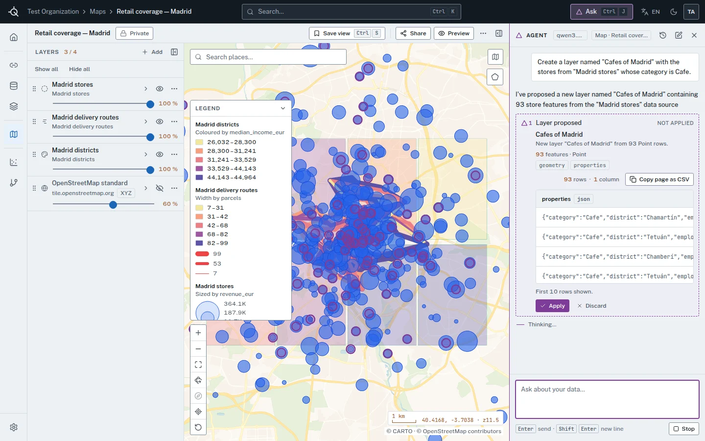
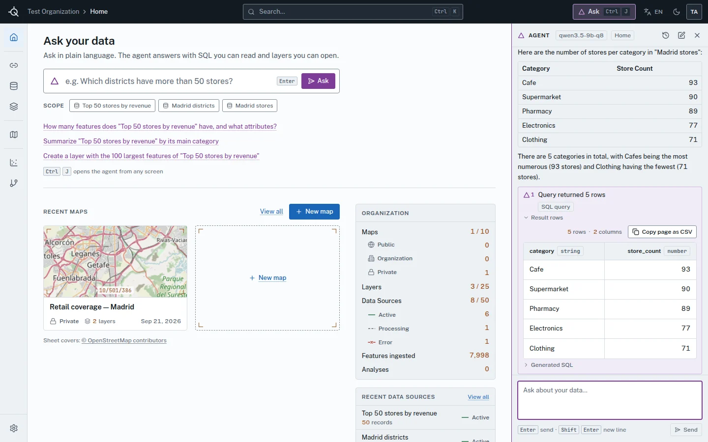
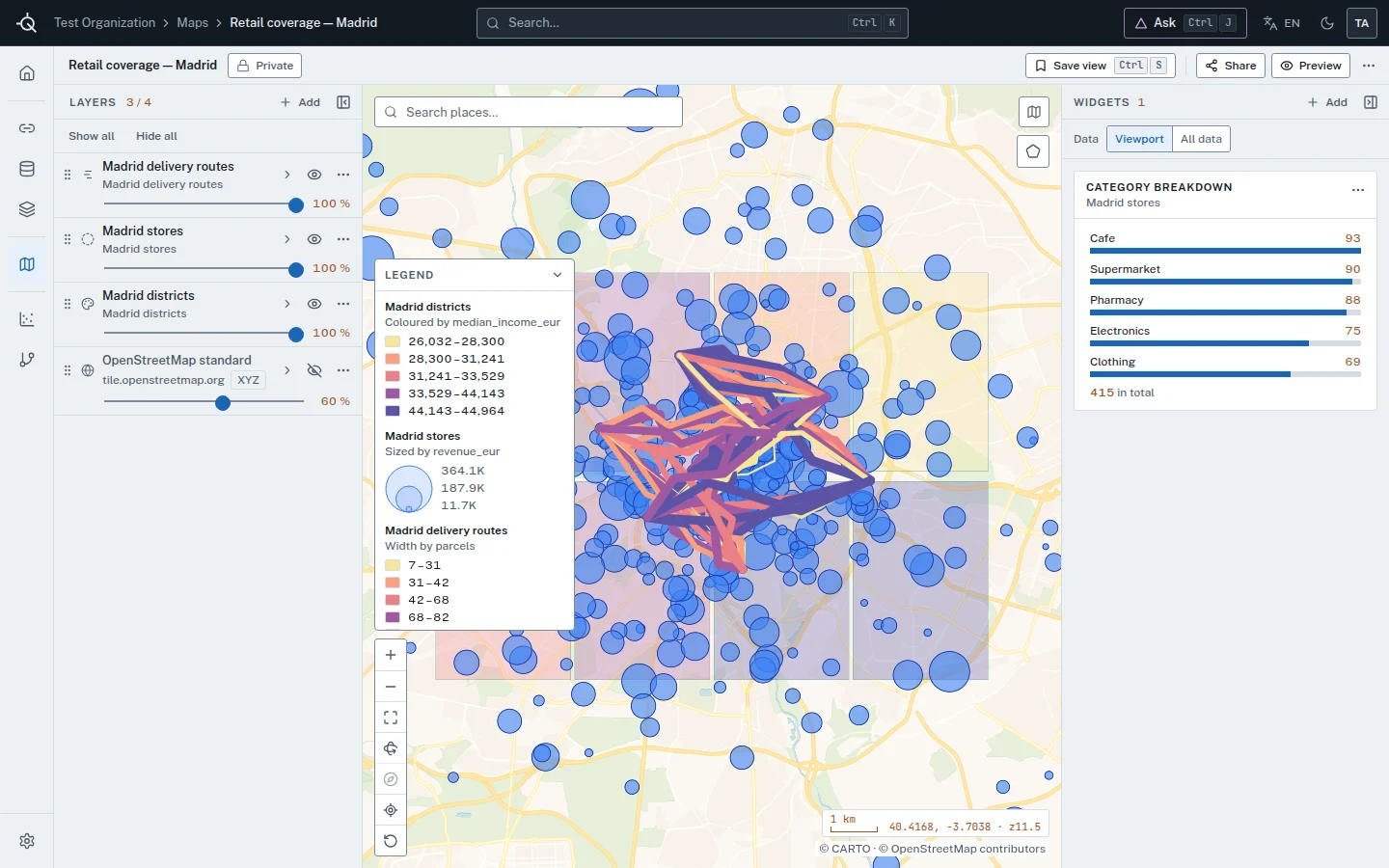
The agent works on real layers, maps and analyses, and proposes each change for a person to apply or discard.
Answers come with SQL you can read. Queries run in a sandbox the database enforces, within a budget per organization.
19 visualizations, H3 hexbins and widgets that cross-filter, in maps you can share, embed or print.
It works with Anthropic, OpenAI or local models through Ollama, vLLM and others. An evaluation command scores it on questions with known answers.
Files, a URL, ArcGIS with incremental refresh, PostGIS, BigQuery or S3.
38 spatial operations, from hot spots to location-allocation.
A DAG on a schedule, with alert rules and signed webhooks.
Figures computed in SQL; the model writes only the prose.
The API has scopes, idempotency and a change feed, and the same key opens a read-only MCP server.
We’ll show it to you working, using the product and its demo materials, and talk through your case.
Ask for a demo